Scenic images (aerial and ground, panoramas, & videos) of everyday rural Oregon
  • Home
  • About
  • Landscapes
    • Columbia County Landscapes
    • Washington County Landscapes >
      • Washington County 360-degree panoramas
    • Yamhill County Landscapes >
      • Yamhill County 360-degree panoramas
    • Multnomah County Landscapes
    • Clackamas County Landscapes
    • Marion County Landscapes
    • Polk County Landscapes
    • Landscape videos
  • Willamette River
    • Willamette River Aerial Panoramas >
      • Columbia River to Oregon City
      • Oregon City to Salem
      • Salem to Springfield
      • The Coast Fork
      • The Middle Fork and the North Fork
    • Willamette River aerial photos >
      • Columbia to Burlingame Bridge
      • Burlingame Bridge to Ross Island Bridge
      • Ross Island to Elk Rock Island
      • Lake Oswego RR Bridge to Hog Island
      • Hog Island to Cedar Island
      • Meldrum Bay Park to Willamette Falls
      • Willamette Park to Wilsonville
      • Butteville Landing to San Salvador Beach
      • Grand Island to Willamette Mission Park
      • Spring Valley Greenway to Sunset Park
      • Buena Vista
    • Willamette River video
  • Cards (PW protected)
  • FAQ
  • Contact Us
  • Search
Picture


​
​

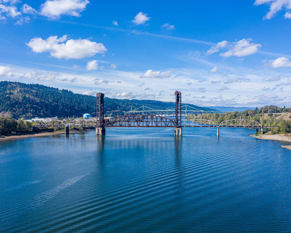
The Burlington Northern Railroad Bridge to just south of the Ross Island Bridge
​

Click on images for maps of the locations of the camera.

The Willamette River in Portland, Oregon
1. Looking downstream at the Burlington Northern Railroad Bridge and beyond to the St. John's Bridge
The Willamette River in Portland, Oregon
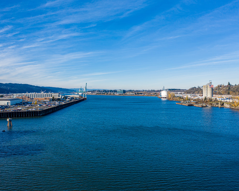
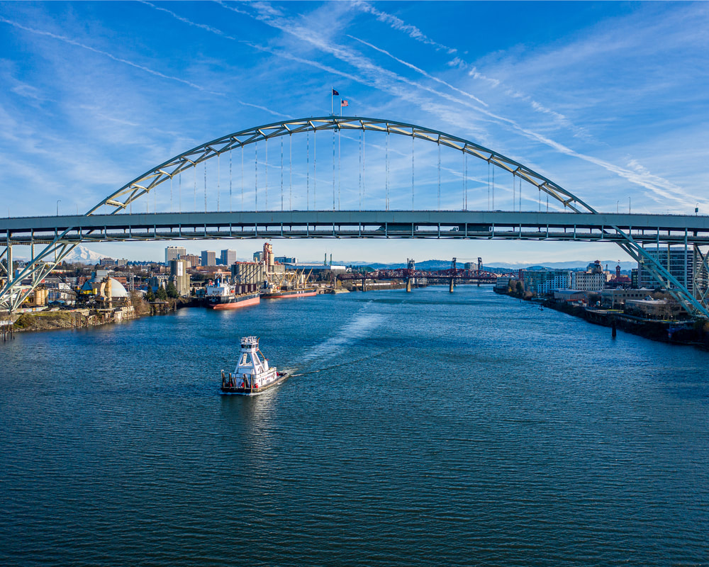
2. The view downstream from just past the Fremont Bridge
The Willamette River in Portland, Oregon
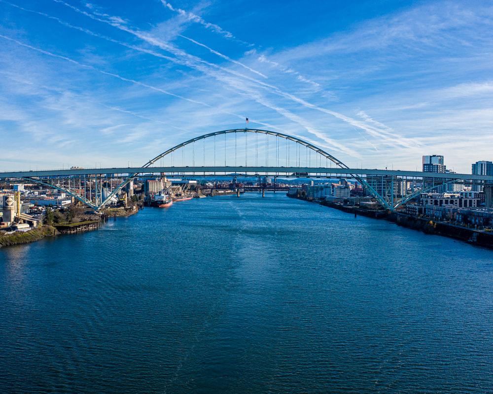
3. Looking upstream toward the Fremont Bridge
The Willamette River in Portland, Oregon
4. Tugboat just downstream of the Fremont Bridge
Map
Bridge over the Willamette River in Portland, Oregon
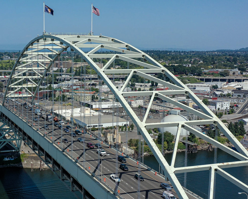
5. The Fremont Bridge from the western edge of the river
Bridge over the Willamette River in Portland, Oregon
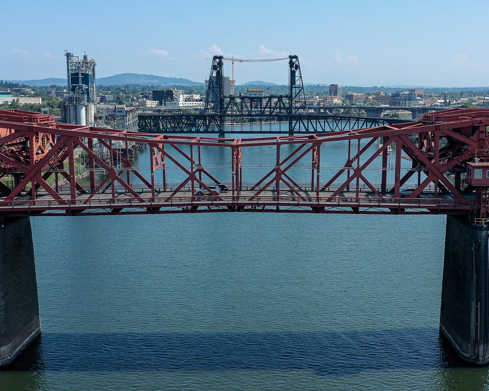
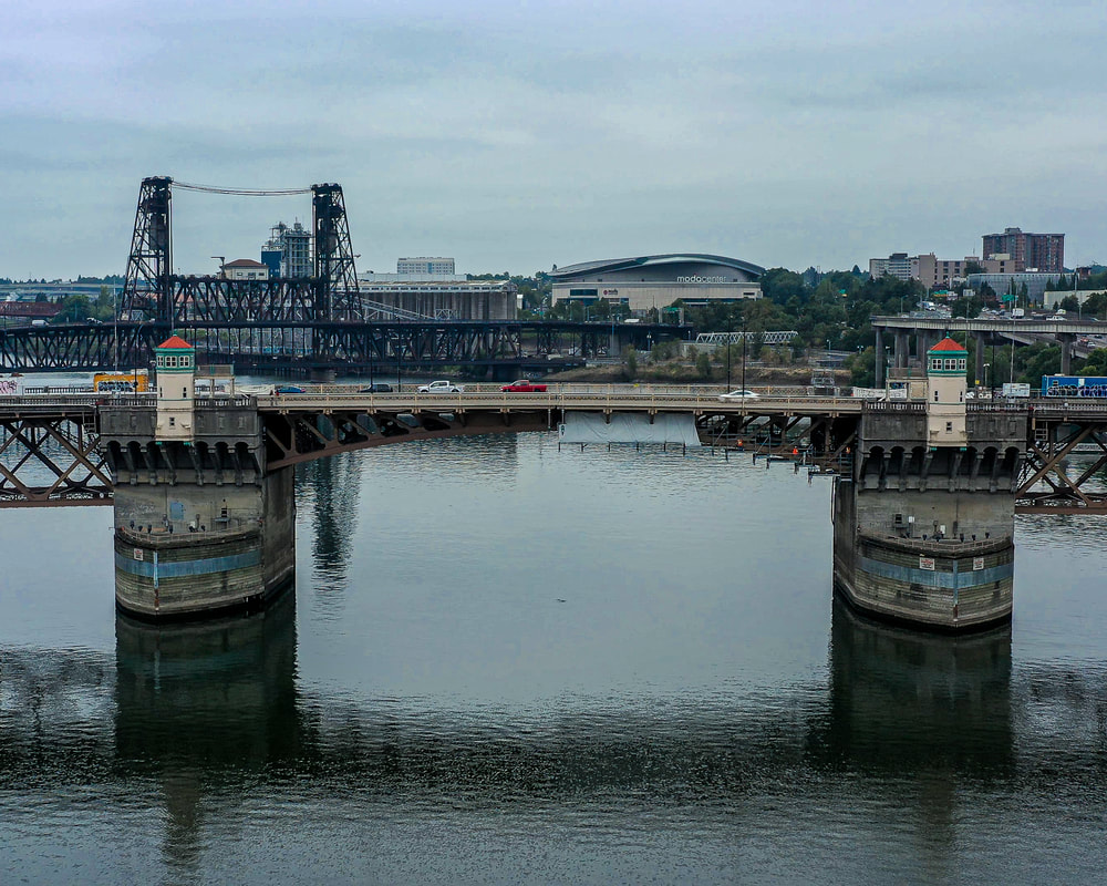
6. The Broadway Bridge, with the Steel Bridge upstream
Bridge over the Willamette River in Portland, Oregon
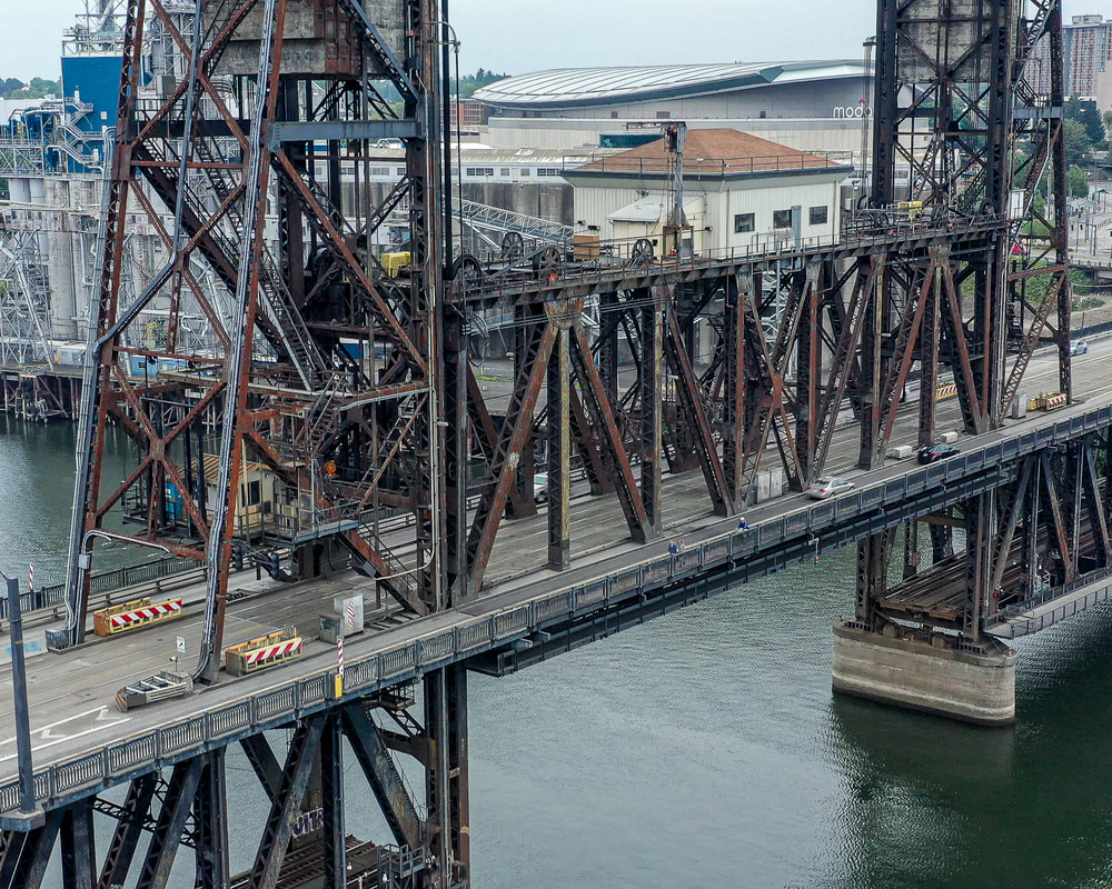
7. The Steel Bridge, looking northeast
Bridge over the Willamette River in Portland, Oregon
8. The view downstream at the Burnside Bridge
Bridge over the Willamette River in Portland, Oregon
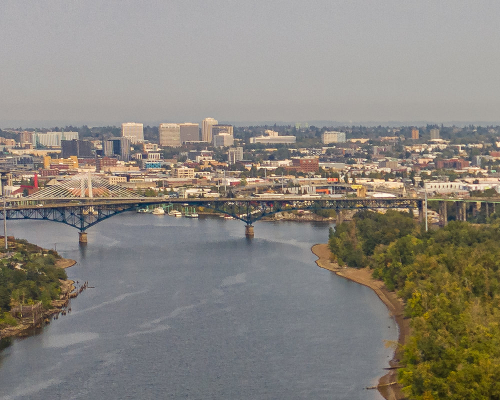
9. The view north to the Ross Island Bridge on a very hazy day
The Willamette River in Portland, Oregon
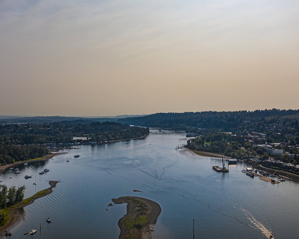
10. Looking upstream to the Sellwood Bridge on a wildfire-haze day
Previous page
Next page
Scenic ground-level photos, interactive aerial
panoramas, and videos of everyday rural Oregon

Site last updated 4/25/2022
  • Home
  • About
  • Landscapes
    • Columbia County Landscapes
    • Washington County Landscapes >
      • Washington County 360-degree panoramas
    • Yamhill County Landscapes >
      • Yamhill County 360-degree panoramas
    • Multnomah County Landscapes
    • Clackamas County Landscapes
    • Marion County Landscapes
    • Polk County Landscapes
    • Landscape videos
  • Willamette River
    • Willamette River Aerial Panoramas >
      • Columbia River to Oregon City
      • Oregon City to Salem
      • Salem to Springfield
      • The Coast Fork
      • The Middle Fork and the North Fork
    • Willamette River aerial photos >
      • Columbia to Burlingame Bridge
      • Burlingame Bridge to Ross Island Bridge
      • Ross Island to Elk Rock Island
      • Lake Oswego RR Bridge to Hog Island
      • Hog Island to Cedar Island
      • Meldrum Bay Park to Willamette Falls
      • Willamette Park to Wilsonville
      • Butteville Landing to San Salvador Beach
      • Grand Island to Willamette Mission Park
      • Spring Valley Greenway to Sunset Park
      • Buena Vista
    • Willamette River video
  • Cards (PW protected)
  • FAQ
  • Contact Us
  • Search