Scenic images (aerial and ground, panoramas, & videos) of everyday rural Oregon
  • Home
  • About
  • Landscapes
    • Columbia County Landscapes
    • Washington County Landscapes >
      • Washington County 360-degree panoramas
    • Yamhill County Landscapes >
      • Yamhill County 360-degree panoramas
    • Multnomah County Landscapes
    • Clackamas County Landscapes
    • Marion County Landscapes
    • Polk County Landscapes
    • Landscape videos
  • Willamette River
    • Willamette River Aerial Panoramas >
      • Columbia River to Oregon City
      • Oregon City to Salem
      • Salem to Springfield
      • The Coast Fork
      • The Middle Fork and the North Fork
    • Willamette River aerial photos >
      • Columbia to Burlingame Bridge
      • Burlingame Bridge to Ross Island Bridge
      • Ross Island to Elk Rock Island
      • Lake Oswego RR Bridge to Hog Island
      • Hog Island to Cedar Island
      • Meldrum Bay Park to Willamette Falls
      • Willamette Park to Wilsonville
      • Butteville Landing to San Salvador Beach
      • Grand Island to Willamette Mission Park
      • Spring Valley Greenway to Sunset Park
      • Buena Vista
    • Willamette River video
  • Cards (PW protected)
  • FAQ
  • Contact Us
  • Search
Picture

​
Ross Island to Elk Rock Island
​

Click on images for maps of the locations of the camera.

The Willamette River in Portland, Oregon
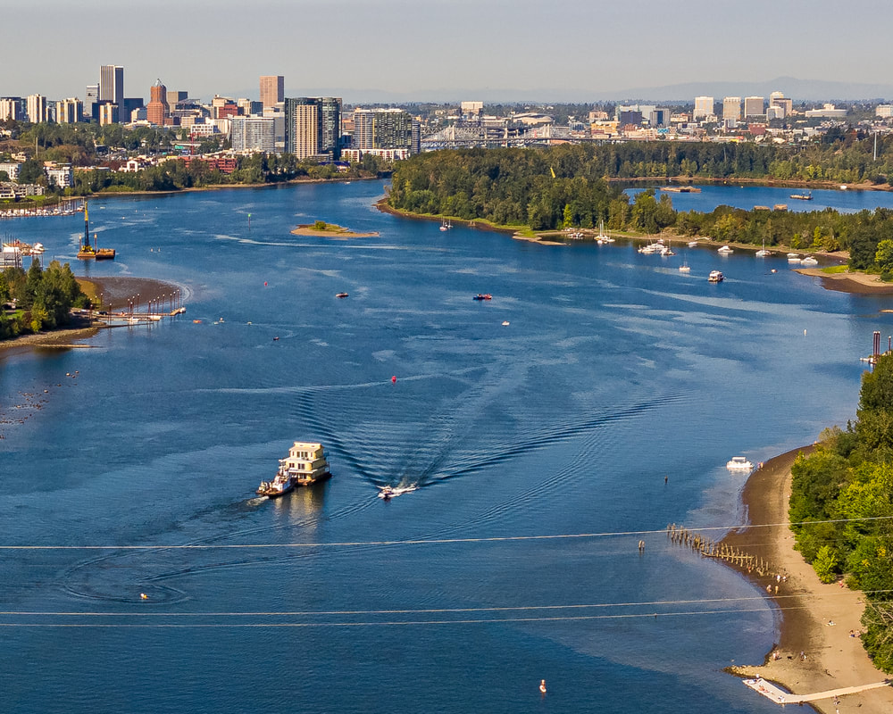
1. The view downstream from near the southern end of Ross Island
The Willamette River in Portland, Oregon
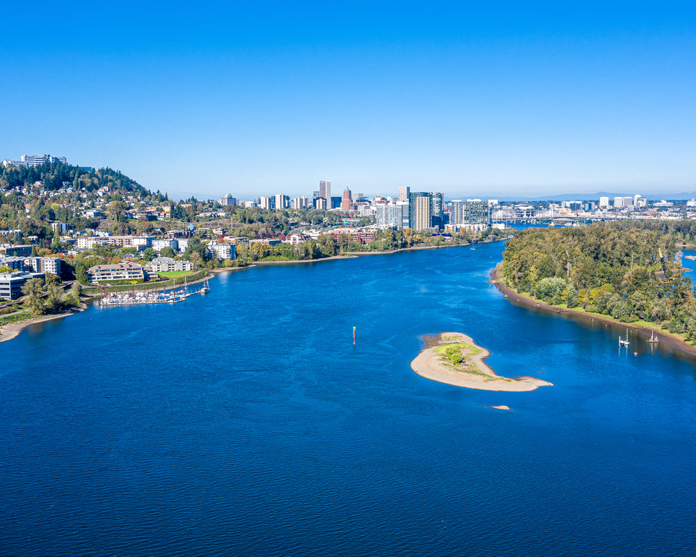
2. The east side of the Willamette from near the southern tip of Ross Island, with Mt. Hood in the background
The Willamette River in Portland, Oregon
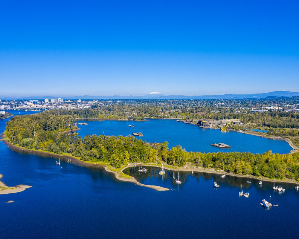
3. The interior of Ross Island
The Willamette River in Portland, Oregon
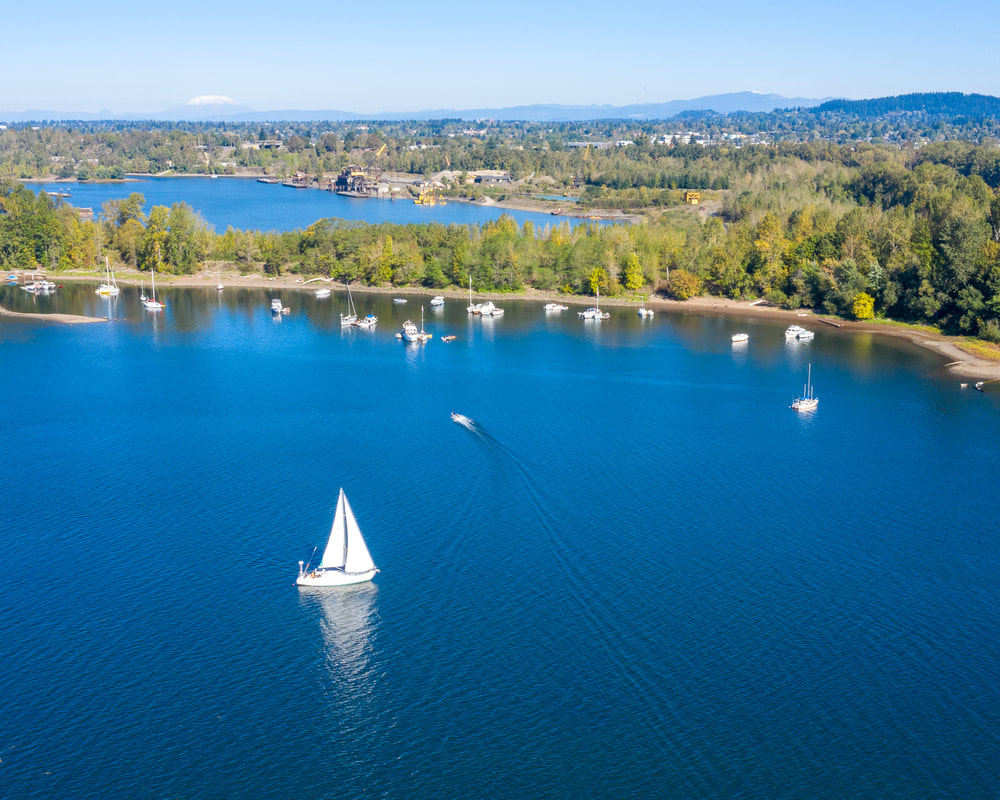
4. Pleasure craft on the west side of Ross Island, with Mt. St. Helens in the background
The Willamette River in Portland, Oregon
5. The view upstream from the southern tip of Ross Island, with the Sellwood Bridge in the distance
The Willamette River in Portland, Oregon
6. Tugboat pushing house down the river toward Ross Island
The Willamette River in Portland, Oregon
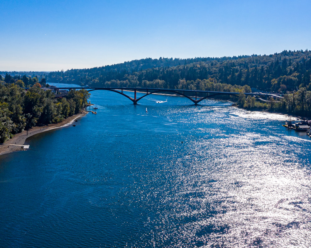
7. The Sellwood Bridge, looking upstream
The Willamette River in Portland, Oregon
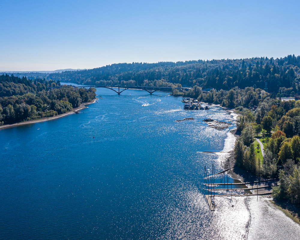
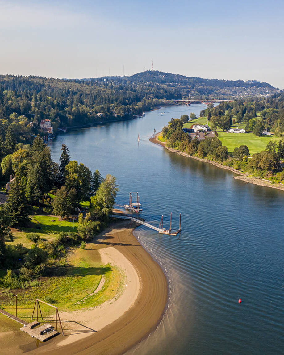
8. Looking downstream to the Sellwood Bridge from near Milwaukie Bay Park
The Willamette River in Portland, Oregon
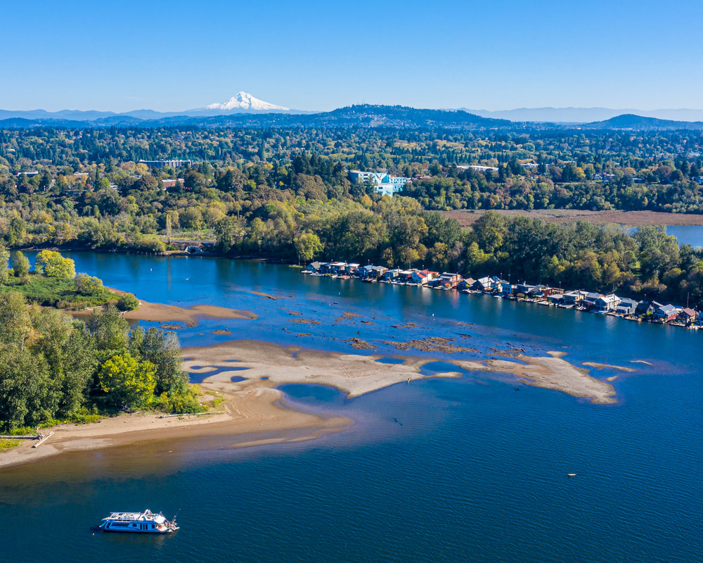
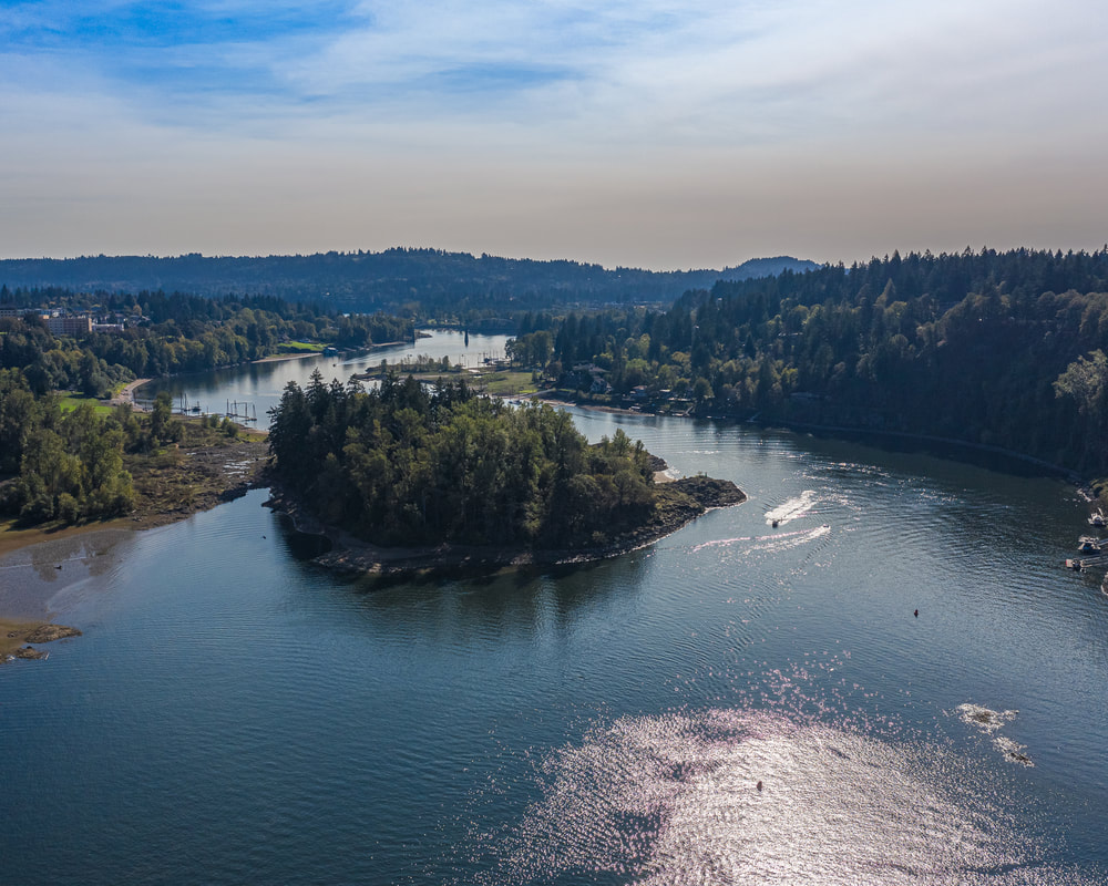
9. Looking upstream toward Elk Rock Island
The Willamette River in Portland, Oregon
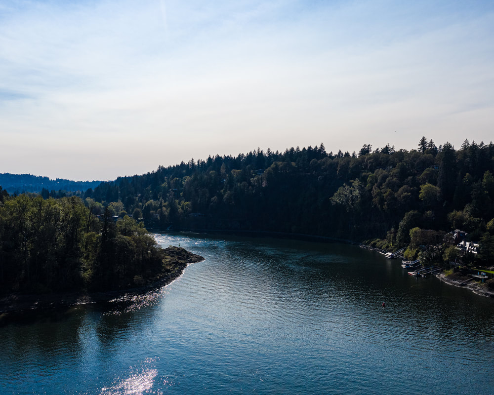
10. Elk Rock island on the left (east) and beyond upstream
Previous page
Next page
Scenic ground-level photos, interactive aerial
panoramas, and videos of everyday rural Oregon

Site last updated 4/25/2022
  • Home
  • About
  • Landscapes
    • Columbia County Landscapes
    • Washington County Landscapes >
      • Washington County 360-degree panoramas
    • Yamhill County Landscapes >
      • Yamhill County 360-degree panoramas
    • Multnomah County Landscapes
    • Clackamas County Landscapes
    • Marion County Landscapes
    • Polk County Landscapes
    • Landscape videos
  • Willamette River
    • Willamette River Aerial Panoramas >
      • Columbia River to Oregon City
      • Oregon City to Salem
      • Salem to Springfield
      • The Coast Fork
      • The Middle Fork and the North Fork
    • Willamette River aerial photos >
      • Columbia to Burlingame Bridge
      • Burlingame Bridge to Ross Island Bridge
      • Ross Island to Elk Rock Island
      • Lake Oswego RR Bridge to Hog Island
      • Hog Island to Cedar Island
      • Meldrum Bay Park to Willamette Falls
      • Willamette Park to Wilsonville
      • Butteville Landing to San Salvador Beach
      • Grand Island to Willamette Mission Park
      • Spring Valley Greenway to Sunset Park
      • Buena Vista
    • Willamette River video
  • Cards (PW protected)
  • FAQ
  • Contact Us
  • Search